US Military Drone Tech: Civilian Applications Explored
The considerable investment by the US military into advanced drone technology is paving the way for revolutionary civilian applications, transforming various sectors from logistics and agriculture to disaster response and public safety, indicating a significant cross-over impact on everyday life.
The landscape of modern technology is continually reshaped by advancements in various fields, with military innovation often serving as a powerful catalyst. One such area gaining immense traction is drone technology. When considering , it becomes clear that these sophisticated aerial vehicles, originally developed for defense, are poised to revolutionize numerous aspects of civilian life, promising efficiencies and new capabilities previously unimagined.
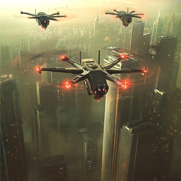
The expanding frontier of military drone technology
The US military’s dedication to advancing drone capabilities is not merely a matter of strategic defense; it’s a profound investment in a technology with far-reaching implications. From surveillance and reconnaissance to precision strikes and logistical support, drones have become indispensable assets in modern warfare. This continuous development cycle, driven by immense research and development budgets, inherently pushes the boundaries of what these autonomous systems can achieve.
Evolution of military drones
The journey of military drones dates back decades, evolving significantly from rudimentary remote-controlled aircraft to highly sophisticated, autonomous systems. Initially used for reconnaissance, their roles expanded to include combat, intelligence gathering, and even resupply missions. This evolution is characterized by several key advancements:
- Enhanced autonomy: Modern military drones are equipped with advanced AI and machine learning, allowing them to operate with reduced human intervention.
- Improved payload capacity: The ability to carry heavier and more diverse equipment, from advanced sensors to specialized armaments.
- Extended range and endurance: Drones can now stay airborne for longer periods and cover vast distances, expanding their operational scope.
- Stealth and counter-detection capabilities: Developed to evade detection, making them more effective in hostile environments.
This relentless pursuit of superior performance in military contexts naturally spills over, creating a rich foundation for civilian technological transfer. The innovations in sensor technology, flight control systems, and data processing, pioneered within the defense sector, represent a treasure trove of potential for non-military applications. The rigorous testing and high reliability demanded by military operations also ensure that the emerging civilian derivatives are robust and dependable.
The implications for civilian use stem directly from the military’s pursuit of robustness, efficiency, and autonomous operation. Each military innovation, whether it be in propulsion systems or communication protocols, contributes to a pool of knowledge that can be adapted for commercial, industrial, or humanitarian purposes. This ongoing process of technological migration underscores how military spending, while primarily for defense, can inadvertently foster significant societal benefits.
Unlocking logistics and delivery: revolutionizing supply chains
One of the most immediate and impactful civilian applications emerging from military drone technology lies within the realm of logistics and delivery. The principles of rapid deployment, precision handling, and secure transportation, honed in military supply operations, are directly transferable to commercial and humanitarian logistics. Imagine a world where critical supplies reach remote areas in minutes, or where e-commerce deliveries bypass congested urban traffic altogether.
Last-mile delivery transformation
The concept of “last-mile delivery,” often the most expensive and inefficient part of the supply chain, is ripe for disruption by drones. Military drones have demonstrated the capability to deliver urgent medical supplies to combat zones or essential equipment to isolated outposts. This operational blueprint can be adapted for:
- Medical emergencies: Delivering blood samples, organs for transplant, or critical medicines to hospitals and accident sites faster than traditional ground transport.
- E-commerce package delivery: Streamlining the delivery of smaller packages directly to consumers’ homes, reducing traffic congestion and emissions.
- Food and beverage delivery: Offering rapid delivery services, especially in areas where road infrastructure is poor or traffic is heavy.
The drones used in these scenarios leverage military-grade navigation systems for precise routing and obstacle avoidance, ensuring safe and efficient delivery. Furthermore, the development of robust, all-weather flight capabilities in military drones means that civilian delivery drones can operate reliably under various environmental conditions, reducing delays and increasing operational consistency.
Logistics in disaster relief
In the aftermath of natural disasters, conventional transportation routes are often inaccessible. Military drones have proven invaluable in delivering aid to cut-off populations, surveying damage, and establishing communication links. This translates directly to civilian disaster relief efforts:
- Rapid assessment: Drones can quickly map damaged areas, providing real-time data for rescue teams to allocate resources effectively.
- Aid delivery: Delivering food, water, and essential supplies to isolated communities when ground access is impossible.
- Search and rescue: Using thermal imaging and advanced sensors to locate missing persons in rubble or dangerous terrain.
The reliability and endurance of military-derived drone systems ensure that these vital operations can proceed without interruption, often saving lives and mitigating further suffering. The sophisticated flight planning software developed for military reconnaissance missions can be repurposed to optimize aid delivery routes in complex, disaster-stricken environments.
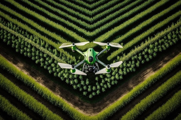
Revolutionizing agriculture and environmental monitoring
Beyond logistics, the sophisticated sensing and mapping capabilities of military drones offer unprecedented opportunities for precision agriculture and environmental protection. Farmers can gain detailed insights into their crops, while environmentalists can monitor ecosystems with unparalleled accuracy. This application leverages the military’s investment in high-resolution imaging and data analysis.
Precision agriculture
Military drones are equipped with multi-spectral and hyperspectral cameras, initially designed for battlefield intelligence. These advanced sensors can detect nuances in vegetation health, soil composition, and water stress that are invisible to the human eye. In agriculture, this translates to:
- Crop health monitoring: Identifying areas of disease, pest infestation, or nutrient deficiencies early, allowing for targeted interventions.
- Optimized irrigation: Pinpointing areas requiring more or less water, leading to significant water conservation and improved yields.
- Yield prediction: Gathering data to accurately forecast harvest sizes, aiding in market planning and resource allocation.
- Weed and pest management: Mapping the precise location of weeds or pests, enabling farmers to apply herbicides or pesticides only where needed, reducing chemical use.
This data-driven approach, directly enabled by military sensor technology transferred to the civilian sector, allows for significantly more efficient and sustainable farming practices. The ability to cover vast expanses of land quickly and gather detailed imagery makes drones a game-changer for large-scale agricultural operations.
Environmental conservation and mapping
The same high-definition mapping and surveillance capabilities that military drones provide for intelligence gathering are immensely valuable for monitoring natural environments. From tracking deforestation to surveying wildlife populations, drones offer a non-intrusive and comprehensive solution.
- Deforestation tracking: Regularly monitoring forests to detect illegal logging activities or track changes in tree cover over time.
- Wildlife protection: Observing animal populations without disturbance, helping to combat poaching and manage protected areas.
- Pollution monitoring: Detecting and mapping pollution sources in water bodies or air, providing data for environmental regulation and cleanup efforts.
- Geological surveys: Mapping terrestrial features for geological assessment, resource exploration, and natural hazard prediction.
The robustness of military drone platforms, designed to operate in challenging environments, ensures that civilian environmental monitoring can be conducted reliably. This capability is critical for informed policy-making and effective conservation strategies, offering a powerful tool for safeguarding the planet’s delicate ecosystems.
Enhancing public safety and emergency services
The tactical and situational awareness capabilities inherent in military drone technology are proving to be invaluable assets for various public safety and emergency services. Police, fire departments, and search and rescue teams are increasingly leveraging drone technology to improve response times, operational efficiency, and officer safety. The shift from battlefield surveillance to civilian public service highlights a significant and positive transfer of technology.
Law enforcement and surveillance
Military drones, with their high-resolution cameras and ability to loiter over areas for extended periods, offer potent tools for law enforcement. Adapted for civilian use, these drones can:
- Crime scene analysis: Providing aerial views of crime scenes, aiding in evidence collection and reconstruction.
- Crowd monitoring: Offering oversight during large public gatherings, helping to manage safety and detect potential issues.
- Search for wanted individuals: Assisting in locating suspects in challenging terrains or densely populated areas.
- Traffic management: Monitoring traffic flow and identifying points of congestion during major events or accidents.
The integration of thermal imaging and night vision capabilities, stemming directly from military applications, allows law enforcement drones to operate effectively in low-light conditions, enhancing their utility significantly. This technology helps officers gain crucial situational awareness without putting themselves at undue risk.
Firefighting and disaster response
For firefighters and first responders, drones offer unparalleled perspectives and data during emergencies, improving their ability to assess and manage hazardous situations.
- Wildfire mapping: Providing real-time thermal maps of wildfires, helping firefighters understand the fire’s spread and allocate resources strategically.
- Structural assessment: Inspecting damaged buildings after disasters without risking human lives.
- Hazardous material incidents: Surveying chemical spills or gas leaks from a safe distance, identifying the source and extent of contamination.
- Emergency communication: Establishing temporary communication networks in areas where traditional infrastructure has failed.
The durability and operational range of military-derived drones mean that they can withstand harsh conditions often encountered during emergencies, providing critical information when human access is too dangerous or impossible. These capabilities empower first responders to make more informed decisions, leading to more effective and safer responses.
Infrastructure inspection and maintenance: new heights of efficiency
Maintaining critical infrastructure, from bridges and power lines to pipelines and wind turbines, is a monumental task. Traditional methods are often labor-intensive, dangerous, and expensive. Here, military drone technology, particularly its precision flight and advanced sensor capabilities, offers a transformative solution, enabling safer, faster, and more cost-effective inspections. This represents a significant leap forward in preventative maintenance and asset management.
Bridge and building inspections
Accessing complex structures like bridges, high-rise buildings, or elevated railways for inspection can be challenging. Drones equipped with high-resolution cameras and thermal imagers can perform these tasks with remarkable efficiency and safety.
- Structural integrity checks: Identifying cracks, corrosion, or fatigue in materials that are difficult to reach manually.
- Thermal imaging for heat loss: Detecting insulation problems in buildings or overheating components in industrial machinery.
- Construction progress monitoring: Providing regular aerial updates on construction sites, ensuring projects stay on schedule and within budget.
- Historical building preservation: Documenting the condition of ancient structures without causing physical damage.
The advanced stability systems developed for military reconnaissance drones allow civilian inspection drones to capture incredibly stable and detailed imagery, even in windy conditions, providing engineers with precise data for their assessments. This reduces the need for scaffolding, cherry pickers, or rope access teams, leading to substantial cost savings and reduced risks.
Energy utility maintenance
Inspecting power lines, wind turbines, and other energy infrastructure often involves working at dangerous heights or in remote locations. Drones offer a safer and more efficient alternative.
- Power line inspection: Identifying damaged insulators, frayed cables, or vegetation encroachment without shutting down power.
- Wind turbine blade inspection: Detecting hairline cracks or erosion on turbine blades that can impact performance.
- Solar panel efficiency: Using thermal cameras to identify underperforming or damaged solar panels in large arrays.
- Pipeline monitoring: Surveying vast stretches of oil and gas pipelines for leaks, corrosion, or environmental encroachment.
The ability of drones to cover large areas quickly and capture detailed images and data points streamlines the inspection process, allowing utility companies to proactively address potential issues before they lead to costly outages or environmental damage. This proactive approach to maintenance, facilitated by military-derived navigational and sensing precision, is transforming the energy sector’s operational protocols.
Mapping, surveying, and urban planning advancements
The precision mapping and surveying capabilities developed for military intelligence and battlefield awareness are now poised to revolutionize civilian applications in urban planning, cartography, and construction. Drones offer an unprecedented ability to rapidly generate accurate 3D models and detailed topographical maps, providing valuable insights for development and environmental management. This technological transfer streamlines processes that were previously time-consuming and expensive.
High-precision mapping and surveying
Military drones are equipped with sophisticated LIDAR (Light Detection and Ranging) and photogrammetry systems for creating highly accurate topographical maps and 3D models of terrain. These systems are invaluable for civilian uses such as:
- Urban development: Creating detailed 3D models of proposed construction sites, aiding in planning, design, and visualization.
- Cadastral surveys: Precisely mapping property boundaries and land use for legal and administrative purposes.
- Volume calculations: Accurately measuring stock piles of materials in quarries or construction sites.
- Archaeological surveys: Mapping historical sites and identifying hidden structures beneath vegetation without intrusive excavation.
The ability to quickly and accurately capture vast amounts of spatial data from an aerial perspective dramatically reduces the time and cost associated with traditional surveying methods. This efficiency is directly attributable to the military’s demand for rapid and precise environmental data.
Smart city initiatives and infrastructure management
The detailed data collected by drones can serve as the backbone for developing “smart cities” where infrastructure is monitored and managed with unprecedented efficiency. Drones contribute significantly to:
- Traffic flow optimization: Real-time monitoring of traffic patterns to adjust signal timings and reduce congestion.
- Utility grid assessment: Mapping and inspecting electrical grids, water pipes, and telecommunication lines to identify vulnerabilities and optimize maintenance schedules.
- Green space management: Assessing the health of urban parks and open spaces, aiding in urban vegetation management and planning.
- Disaster preparedness: Creating up-to-date city models that can be used for emergency response planning and damage assessment after natural disasters.
The continuous and dynamic data collection capabilities of military-inspired drone systems provide urban planners with the tools needed to design more resilient, efficient, and livable cities. This proactive approach to urban management is becoming increasingly vital in rapidly expanding populations, illustrating the profound societal benefits derived from defense technology.

Challenges and considerations for civilian drone integration
While the civilian applications of military drone technology are vast and promising, their widespread integration is not without challenges. These include regulatory hurdles, public perception concerns, privacy issues, and the need for robust safety protocols. Addressing these considerations is essential for unlocking the full potential of this transformative technology.
Regulatory frameworks and airspace management
The skies are becoming increasingly crowded, and integrating autonomous drones into regulated airspace requires rigorous regulatory frameworks. Military-grade reliability, while a boon, doesn’t automatically translate to seamless integration into civilian aviation without clear rules.
- Air traffic control: Developing systems to safely manage thousands of autonomous drones alongside manned aircraft.
- Certification and licensing: Establishing robust processes for certifying drone operators and the drones themselves.
- Standardization: Creating universal standards for drone communication, navigation, and safety features.
- International cooperation: Harmonizing regulations across different countries to facilitate cross-border drone operations.
Legislators and aviation authorities are working hard to catch up with the rapid pace of technological development, balancing innovation with safety and security concerns. The military’s experience with segregated airspace and specialized flight corridors might offer some lessons for complex civilian air traffic management.
Privacy and public perception
The surveillance capabilities of military drones raise significant privacy concerns when applied to civilian contexts. Public acceptance of widespread drone use will largely depend on how these concerns are addressed.
- Data collection and usage: Clear guidelines on what data drones can collect, how it’s stored, and who has access to it.
- Facial recognition and identification: Debates on the ethics of using drone-mounted cameras for identifying individuals without consent.
- Noise pollution: Managing the environmental impact of drone operations, particularly in urban areas.
- Public trust: Building confidence in drone technology through transparent operations and demonstrated benefits.
Open dialogue and robust ethical frameworks are crucial to ensure that the benefits of drone technology outweigh potential infringements on privacy and individual liberties. The public needs assurances that these powerful tools will be used responsibly and accountably, avoiding the perception of constant surveillance.
Security risks and misuse
The very capabilities that make drones valuable—their ability to carry payloads and operate autonomously—also present security risks if they fall into the wrong hands or are misused.
- Malicious use: Preventing drones from being used for smuggling, espionage, or terrorist activities.
- Cybersecurity: Protecting drones from hacking and unauthorized control, given their reliance on interconnected systems.
- Collisions and accidents: Mitigating the risk of drones colliding with manned aircraft or falling from the sky due to malfunction.
- Counter-drone technology: Developing effective measures to detect and neutralize rogue or threatening drones.
Addressing these security concerns requires a multi-faceted approach, combining advanced technological solutions with strict regulatory oversight and international cooperation. The lessons learned from military cybersecurity and anti-drone measures can provide valuable insights for protecting civilian drone infrastructure.
| Key Area | Civilian Benefit |
|---|---|
| 📦 Logistics & Delivery | Faster, more efficient last-mile delivery and critical aid in disaster relief. |
| 🌾 Agriculture & Environment | Precision farming, crop monitoring, and detailed environmental conservation. |
| 🚨 Public Safety | Enhanced crime scene analysis, fire mapping, and search & rescue operations. |
| 🏗️ Infrastructure Inspection | Safer, more efficient maintenance of bridges, power lines, and other critical assets. |
Frequently Asked Questions
▼
The US military is heavily investing in drone technology to enhance its strategic capabilities, including surveillance, reconnaissance, precision strikes, and logistical support. Drones offer significant advantages in terms of risk reduction for personnel, operational efficiency, and ability to access dangerous or remote areas, making them indispensable modern warfare assets.
▼
Military drone technology transfers to civilian use through the adaptation of advanced components and systems. Innovations in sensor technology, autonomous flight software, robust communication systems, and durable materials, originally developed for military applications, are repurposed for commercial and public service roles, such as delivery, agriculture, and emergency response.
▼
The primary civilian applications for military-derived drone technology are diverse, encompassing logistics and delivery, precision agriculture, environmental monitoring, public safety, infrastructure inspection, and advanced mapping. These applications benefit from the military’s emphasis on reliability, endurance, and sophisticated sensory capabilities in challenging environments.
▼
Yes, significant challenges exist in integrating military drone technology into civilian life. These include developing comprehensive regulatory frameworks for airspace management, addressing public concerns regarding privacy and surveillance, and mitigating security risks such as misuse or cyberattacks. Overcoming these hurdles is crucial for widespread adoption.
▼
Civilian drones are progressively moving towards greater autonomy, learning from military advancements in AI and machine learning. While regulatory and ethical considerations may limit the degree of autonomy in certain civilian applications, the trend is towards increasingly sophisticated self-operating capabilities, especially for tasks like delivery, inspection, and mapping, enhancing efficiency and safety.
Conclusion
The formidable investment the US military channels into drone technology is not confined to the battlefield; its transformative echoes resonate profoundly in the civilian sphere. From revolutionizing the intricate webs of logistics and delivery to fostering unparalleled precision in agriculture and environmental stewardship, and from bolstering the efficacy of public safety operations to ushering in a new era of infrastructure management, these military innovations are steadily charting a course for a more connected, efficient, and responsive civilian world. While challenges, particularly concerning regulatory clarity, privacy, and security, necessitate careful navigation, the trajectory indicates that the sophisticated capabilities honed for defense will continue to be a powerful catalyst for progress across a multitude of industries, fundamentally reshaping our daily lives.


